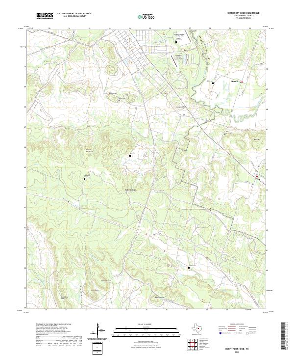
2022 Map of North Fort Hood
USGS Topo · Published 2022About this map
The Leon River drainage system defines the eastern edge of this landscape, where the settlement of Mound sits at a junction of rural routes. To the west, the terrain rises into the Henson Mountains and prominent elevations such as Dalton Mtn and Langford Mtn. The military character of the area is evident in the inclusion of the Longhorn Auxiliary Landing Strip and Shorthorn Auxiliary Landing Strip near the northern boundary. Numerous family and community burial grounds, including King Smith Cem and Ruth Cem, are scattered across the hills and creek valleys, offering significant points of interest for genealogists tracing local lineage. The road network, comprising routes like W Range Rd and E Range Rd, navigates the complex topography of ridges and hollows like Egypt Hollow, illustrating how modern infrastructure follows the natural contours of the Central Texas landscape.
Find a feature on this map
56 named features on this map. Tap any name to fly to it.
Don’t see what you’re looking for? This feature index may not catch every label — zoom into the map to look around manually.
Map Details
Editions of this 2022 North Fort Hood Map
This is the sole edition of this map. No revisions or reprints were ever made.
Other maps of this area

1894 · Gatesville
USGS Topo · 1:125,000

1924 · Gatesville 4-a
USGS Topo · 1:48,000

1930 · Killeen
USGS Topo · 1:62,500

1947 · Fort Hood
USGS Topo · 1:62,500

1947 · Bland
USGS Topo · 1:24,000

1947 · Fort Hood
USGS Topo · 1:24,000

1947 · Purmela
USGS Topo · 1:62,500

1947 · Post Oak Mountain
USGS Topo · 1:24,000

1947 · Killeen
USGS Topo · 1:62,500

1947 · Oglesby
USGS Topo · 1:24,000