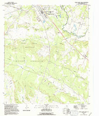
1994 Map of North Fort Hood
USGS Topo · Published 1995About this map
The Fort Hood Military Reservation dominates this mid-1990s landscape, illustrating the extensive infrastructure of one of the world's largest military installations. The map provides a detailed view of the North Fort Hood cantonment area, including its distinctive landing strip and heliport facilities. Beyond the military boundary, the rural character of Coryell County persists in small settlements like Mound and Flat. The terrain is defined by the winding course of the Leon River and the prominent heights of the Dalton Mountains and Henson Mountains. For those tracing local heritage, several community anchors remain visible, including the White Mound Ch and various historic burial grounds such as Pleasant Grove Cem, Ruth Cem, and Friendship Cem. The presence of numerous named points like Stephenson Point and Rambo Point suggests a landscape long shaped by local families and natural landmarks.
Find a feature on this map
36 named features on this map. Tap any name to fly to it.
Don’t see what you’re looking for? This feature index may not catch every label — zoom into the map to look around manually.
Map Details
Editions of this 1994 North Fort Hood Map
This is the sole edition of this map. No revisions or reprints were ever made.
Other maps of this area

1894 · Gatesville
USGS Topo · 1:125,000

1924 · Gatesville 4-a
USGS Topo · 1:48,000

1930 · Killeen
USGS Topo · 1:62,500

1947 · Fort Hood
USGS Topo · 1:62,500

1947 · Bland
USGS Topo · 1:24,000

1947 · Fort Hood
USGS Topo · 1:24,000

1947 · Purmela
USGS Topo · 1:62,500

1947 · Post Oak Mountain
USGS Topo · 1:24,000

1947 · Killeen
USGS Topo · 1:62,500

1947 · Oglesby
USGS Topo · 1:24,000