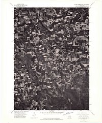
1975 Map of North Freedom NW
USGS Topo · Published 1976About this map
The Baraboo River winds through the northeast corner of this 1975 aerial study, anchoring a landscape defined by the intersection of riparian geography and systematic agriculture in Sauk County. Unlike traditional line maps, this orthophotoquad provides a direct visual record of the land as it appeared in the mid-1970s, revealing the intricate patterns of contour plowing and field management that shaped the rural economy of the time. The settlement of Rock Springs stands out near the river, while the smaller cluster of La Rue marks a point of historical interest for those tracing the development of local villages. The map captures the exact footprint of farmsteads and woodlots during a period of transition in Wisconsin farming, offering a literal view of property lines and vegetation that conventional topographic symbols often omit.
Find a feature on this map
3 named features on this map. Tap any name to fly to it.
Don’t see what you’re looking for? This feature index may not catch every label — zoom into the map to look around manually.
Map Details
Editions of this 1975 North Freedom NW Map
2 editions found
Other maps of this area

1901 · Denzer
USGS Topo · 1:62,500

1901 · The Dells
USGS Topo · 1:62,500

1905 · Richland Center
USGS Topo · 1:125,000

1956 · Reedsburg
USGS Topo · 1:62,500

1957 · Wisconsin Dells
USGS Topo · 1:62,500

1957 · Madison
USGS Topo · 1:250,000

1958 · North Freedom
USGS Topo · 1:62,500

1958 · La Crosse
USGS Topo · 1:250,000

1960 · Madison
USGS Topo · 1:250,000

1960 · Plain
USGS Topo · 1:62,500