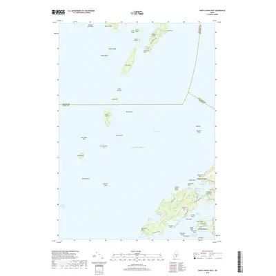
2018 Map of North Haven West
USGS Topo · Published 2018About this map
North Haven and the surrounding island chains within West Penobscot Bay are detailed in this coastal topographical study. The landscape is defined by the complex interface of the Atlantic Ocean and the intricate shoreline of the Fox Islands, where Southern Harbor and Pulpit Harbor provide protected maritime access. On the mainland of North Haven, cultural landmarks such as Fuller Cem and Seaview Cem are noted alongside local infrastructure like the Witherspoons Landing Strip, Inc.
Find a feature on this map
72 named features on this map. Tap any name to fly to it.
Don’t see what you’re looking for? This feature index may not catch every label — zoom into the map to look around manually.
Map Details
Editions of this 2018 North Haven West Map
This is the sole edition of this map. No revisions or reprints were ever made.
Other maps of this area

1902 · Castine
USGS Topo · 1:62,500

1904 · Castine
USGS Topo · 1:62,500

1904 · Vinalhaven
USGS Topo · 1:62,500

1904 · Rockland
USGS Topo · 1:62,500

1905 · Penobscot Bay
USGS Topo · 1:125,000

1906 · Rockland
USGS Topo · 1:62,500

1915 · Belfast
USGS Topo · 1:62,500

1917 · Belfast
USGS Topo · 1:62,500

1941 · Belfast
USGS Topo · 1:62,500

1941 · Rockland
USGS Topo · 1:62,500