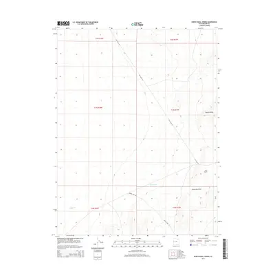
2014 Map of North Knoll Spring
USGS Topo · Published 2014About this map
North Knoll Spring serves as a vital water source in this arid corner of Millard County, situated near the intersection of several township boundaries including t18s r18w and t18s r17w. The landscape is defined by elevated terrain features like Plympton Ridge and Rattlesnake Bench, which overlook the seasonal drainage of Browns Wash. Transportation through this remote high-desert environment relies on a network of unpaved routes, most notably Foot Ranch Rd and Browns Wash Rd, which provide access to the area's grazing lands and the drainage of Red Gulch. The map illustrates the sparse infrastructure and essential water points required for ranching operations in the eastern Great Basin during the early 21st century.
Find a feature on this map
13 named features on this map. Tap any name to fly to it.
Don’t see what you’re looking for? This feature index may not catch every label — zoom into the map to look around manually.
Map Details
Editions of this 2014 North Knoll Spring Map
This is the sole edition of this map. No revisions or reprints were ever made.
Other maps of this area

1908 · Fish Springs
USGS Topo · 1:250,000

1910 · Fish Springs
USGS Topo · 1:250,000

1953 · Delta
USGS Topo · 1:250,000

1958 · Delta
USGS Topo · 1:250,000

1959 · Cowboy Pass
USGS Topo · 1:62,500

1960 · Conger Range
USGS Topo · 1:62,500

1960 · Gandy
USGS Topo · 1:62,500

1960 · Conger Mountain
USGS Topo · 1:62,500

1962 · Delta
USGS Topo · 1:250,000
1981 · Tule Valley
USGS Topo · 1:100,000