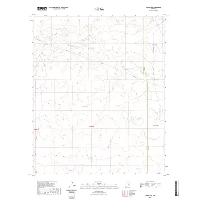
2023 Map of North Lake
USGS Topo · Published 2023About this map
Arroyo del Macho winds across this high plains landscape of the Chihuahuan Desert, providing a rare seasonal drainage route through the undulating terrain. The area is defined by its water management systems, notably North Lake and a series of livestock-supporting features such as Percella Tank, Sec Tank, and Big Tank. These artificial catchments suggest the long-standing importance of ranching in this portion of New Mexico, where surface water is scarce. The geography is further marked by the Lincoln and Chaves County line, which divides the eastern reaches of the map. Infrastructure is minimal, consisting primarily of utility access routes like Pipe Line Rd and rural connectors such as Stargrass Rd, reflecting a landscape dedicated to large-scale land use and pastoral industry rather than urban development.
Find a feature on this map
18 named features on this map. Tap any name to fly to it.
Don’t see what you’re looking for? This feature index may not catch every label — zoom into the map to look around manually.
Map Details
Editions of this 2023 North Lake Map
This is the sole edition of this map. No revisions or reprints were ever made.
Other maps of this area

1936 · Arabela
USGS Topo · 1:48,000

1942 · Arabela
USGS Topo · 1:62,500

1955 · Roswell
USGS Topo · 1:250,000

1958 · Roswell
USGS Topo · 1:250,000

1962 · Roswell
USGS Topo · 1:250,000

1967 · Round Mountain SE
USGS Topo · 1:24,000

1967 · North Lake
USGS Topo · 1:24,000

1967 · White Flat
USGS Topo · 1:24,000

1967 · Round Mountain
USGS Topo · 1:24,000

1967 · Chivata Canyon
USGS Topo · 1:24,000