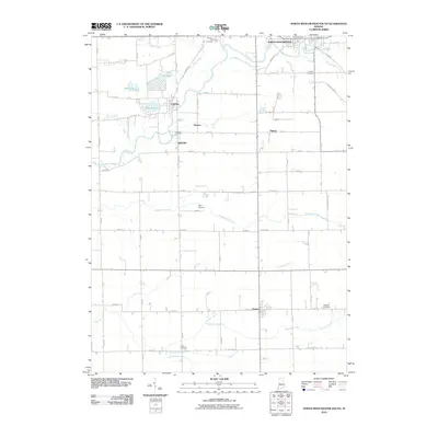
2010 Map of North Manchester South
USGS Topo · Published 2010About this map
The Eel River winds through this Wabash County landscape, anchoring several small rural communities that developed along its course and the surrounding agricultural plains. The northern edge of the map features the outskirts of North Manchester, while the central portion reveals the clustered settlements of Laketon, Ijamsville, and Newton. This area is defined by a complex network of glacial features and drainage improvements, including Round Lake, Long Lake, and Mud Lake, connected by numerous engineered waterways such as Miller Ditch and Staver Ditch.
Find a feature on this map
60 named features on this map. Tap any name to fly to it.
Don’t see what you’re looking for? This feature index may not catch every label — zoom into the map to look around manually.
Map Details
Editions of this 2010 North Manchester South Map
This is the sole edition of this map. No revisions or reprints were ever made.
Other maps of this area

1950 · Lagro
USGS Topo · 1:24,000

1951 · Lagro
USGS Topo · 1:24,000

1951 · Richvalley
USGS Topo · 1:24,000

1952 · Wabash
USGS Topo · 1:24,000

1953 · Fort Wayne
USGS Topo · 1:250,000

1953 · Muncie
USGS Topo · 1:250,000

1956 · Muncie
USGS Topo · 1:250,000

1956 · Fort Wayne
USGS Topo · 1:250,000

1961 · Silver Lake
USGS Topo · 1:24,000

1961 · Roann
USGS Topo · 1:24,000