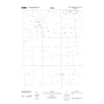
2013 Map of North Manchester South
USGS Topo · Published 2013About this map
The Eel River winds through this agricultural landscape in Wabash County, anchoring several small rural communities that define the region's 21st-century character. Laketon sits near the northwestern edge, positioned between the river and the waters of Round Lake and Mud Lake. Further south, the settlement of Urbana serves as a local crossroads, while smaller hamlets like Ijamsville, Newton, and Bolivar are scattered across the interior.
Find a feature on this map
54 named features on this map. Tap any name to fly to it.
Don’t see what you’re looking for? This feature index may not catch every label — zoom into the map to look around manually.
Map Details
Editions of this 2013 North Manchester South Map
This is the sole edition of this map. No revisions or reprints were ever made.
Other maps of this area

1950 · Lagro
USGS Topo · 1:24,000

1951 · Lagro
USGS Topo · 1:24,000

1951 · Richvalley
USGS Topo · 1:24,000

1952 · Wabash
USGS Topo · 1:24,000

1953 · Fort Wayne
USGS Topo · 1:250,000

1953 · Muncie
USGS Topo · 1:250,000

1956 · Muncie
USGS Topo · 1:250,000

1956 · Fort Wayne
USGS Topo · 1:250,000

1961 · Silver Lake
USGS Topo · 1:24,000

1961 · Roann
USGS Topo · 1:24,000