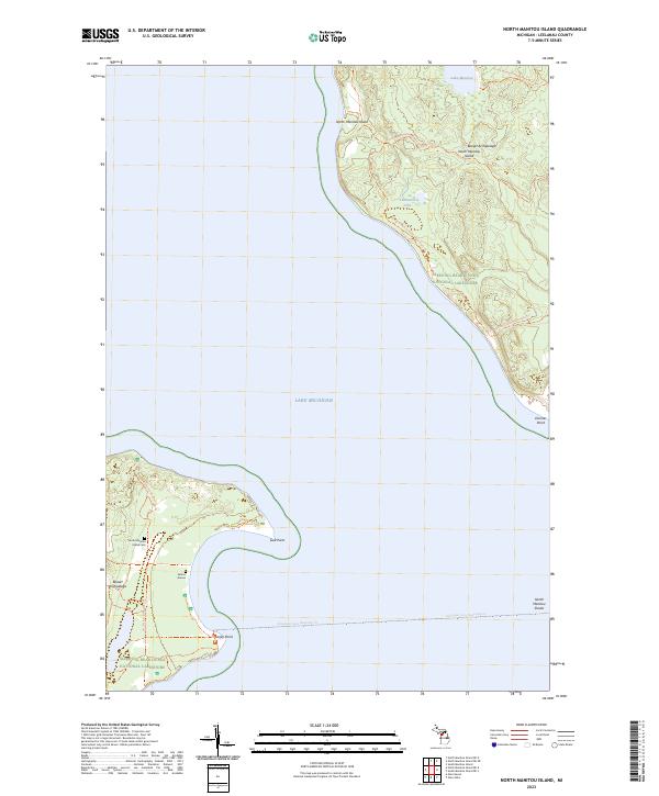
2023 Map of North Manitou Island
USGS Topo · Published 2023About this map
North Manitou Island and its surrounding waters in the Beaver Archipelago represent a preserved landscape within the Sleeping Bear Dunes National Lakeshore. The map documents a rugged island geography where inland water bodies like Lake Manitou and Tamarack Lake sit perched above the shoreline of Lake Michigan. Human history is marked by the presence of the South Manitou Island Cem and the poignant landmark of Sailors Graves, which speak to the maritime risks inherent to the North Manitou Shoals. Transportation is limited to a network of footpaths, including the North Manitou Island Main Trails Trl, and the Passenger Ferry (Seasonal) Trl that connects these isolated points of the Sleeping Bear Dunes Wilderness to the mainland.
Find a feature on this map
20 named features on this map. Tap any name to fly to it.
Don’t see what you’re looking for? This feature index may not catch every label — zoom into the map to look around manually.
Map Details
Editions of this 2023 North Manitou Island Map
This is the sole edition of this map. No revisions or reprints were ever made.
Other maps of this area

1954 · Traverse City
USGS Topo · 1:250,000

1954 · Escanaba
USGS Topo · 1:250,000

1954 · Manitowoc
USGS Topo · 1:250,000

1955 · Cheboygan
USGS Topo · 1:250,000

1956 · North Manitou
USGS Topo · 1:62,500

1957 · Escanaba
USGS Topo · 1:250,000

1957 · Empire
USGS Topo · 1:62,500

1957 · Maple City
USGS Topo · 1:62,500

1958 · Escanaba
USGS Topo · 1:250,000

1958 · Cheboygan
USGS Topo · 1:250,000