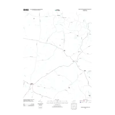
2013 Map of North Middletown
USGS Topo · Published 2013About this map
North Middletown anchors this section of Bourbon County, where the landscape is defined by the winding paths of Hinkston Cr and Boone Cr. The rural character of the region is preserved through a network of small, scattered settlements including Jackstown, Plum, and Little Rock. A significant historical landmark, the Edward Boone Grave, sits near the intersection of See Rd and Highway 57, marking the resting place of Daniel Boone’s brother.
Find a feature on this map
55 named features on this map. Tap any name to fly to it.
Don’t see what you’re looking for? This feature index may not catch every label — zoom into the map to look around manually.
Map Details
Editions of this 2013 North Middletown Map
This is the sole edition of this map. No revisions or reprints were ever made.
Other maps of this area

1952 · Sharpsburg
USGS Topo · 1:24,000

1952 · Paris East
USGS Topo · 1:24,000

1952 · Mount Sterling
USGS Topo · 1:24,000

1952 · Austerlitz
USGS Topo · 1:24,000

1952 · North Middletown
USGS Topo · 1:24,000
1952 · Sideview
USGS Topo · 1:24,000

1953 · Carlisle
USGS Topo · 1:24,000

1953 · Moorefield
USGS Topo · 1:24,000

1953 · Millersburg
USGS Topo · 1:24,000

1956 · Louisville
USGS Topo · 1:250,000