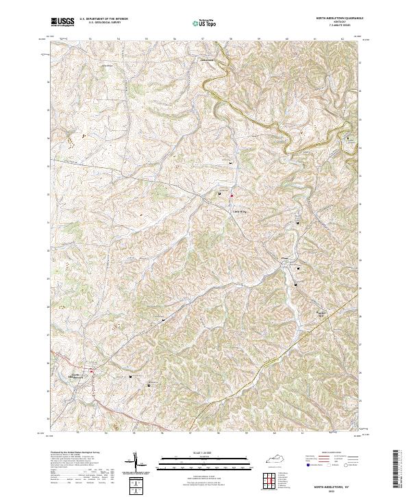
2022 Map of North Middletown
USGS Topo · Published 2022About this map
North Middletown anchors the southwestern corner of this landscape where the undulating Bluegrass region meets the boundaries of Bourbon, Nicholas, and Montgomery counties. The area is defined by a dense network of country roads like Cane Ridge Rd and Jackstown Rd that connect small rural centers such as Little Rock, Plum, and Jackstown. These settlements are interspersed with numerous family burial sites and historical markers, most notably the Edward Boone Grave situated near Boone Cr, reflecting the deep ancestral roots of the region.
Find a feature on this map
63 named features on this map. Tap any name to fly to it.
Don’t see what you’re looking for? This feature index may not catch every label — zoom into the map to look around manually.
Map Details
Editions of this 2022 North Middletown Map
This is the sole edition of this map. No revisions or reprints were ever made.
Other maps of this area

1952 · Sharpsburg
USGS Topo · 1:24,000

1952 · Paris East
USGS Topo · 1:24,000

1952 · Mount Sterling
USGS Topo · 1:24,000

1952 · Austerlitz
USGS Topo · 1:24,000

1952 · North Middletown
USGS Topo · 1:24,000
1952 · Sideview
USGS Topo · 1:24,000

1953 · Carlisle
USGS Topo · 1:24,000

1953 · Moorefield
USGS Topo · 1:24,000

1953 · Millersburg
USGS Topo · 1:24,000

1956 · Louisville
USGS Topo · 1:250,000