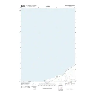
2010 Map of North of Dunkirk
USGS Topo · Published 2010About this map
Lake Erie dominates this coastal survey, where the waters meet the northern edge of Chautauqua County. The map provides a focused look at the shoreline just north of the city center, highlighting the transition from open water to the developed waterfront at Wright Park Beach. Inland, a network of local thoroughfares including Middle Rd and Harrington Rd connects the rural-suburban fringe, punctuated by the Dunkirk Conference Grounds. Small watercourses like Beaver Creek and Scott Creek drain toward the lake, marking the low-lying coastal topography. This 2010 edition by the U.S. Geological Survey preserves the specific layout of lakeside properties and parklands before later 21st-century shoreline modifications or residential shifts.
Find a feature on this map
9 named features on this map. Tap any name to fly to it.
Don’t see what you’re looking for? This feature index may not catch every label — zoom into the map to look around manually.
Map Details
Editions of this 2010 North of Dunkirk Map
This is the sole edition of this map. No revisions or reprints were ever made.
Other maps of this area

1899 · Silver Creek
USGS Topo · 1:62,500

1900 · Dunkirk
USGS Topo · 1:62,500

1900 · Cherry Creek
USGS Topo · 1:62,500

1941 · Cherry Creek
USGS Topo · 1:62,500

1943 · Dunkirk
USGS Topo · 1:62,500

1943 · Silver Creek
USGS Topo · 1:24,000

1944 · Silver Creek
USGS Topo · 1:31,680

1954 · Forestville
USGS Topo · 1:24,000
1954 · Dunkirk
USGS Topo · 1:24,000
1954 · Brocton
USGS Topo · 1:24,000