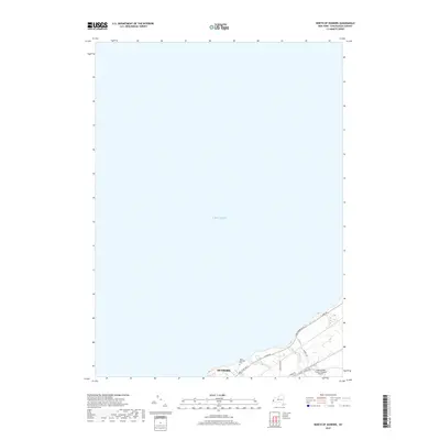
2019 Map of North of Dunkirk
USGS Topo · Published 2019About this map
Lake Erie dominates the northern expanse of this 2019 survey, illustrating the narrow coastal strip of Chautauqua County just east of the city center. This portion of Dunkirk is defined by its transition from urban infrastructure to lakefront residential and transportation corridors. The Chautauqua County/Dunkirk Airport anchors the southeastern corner, while the Saint Hyacinth Cem serves as a prominent local landmark along Lake Shore Dr E. The landscape is etched by small drainage patterns, specifically Scott Cr and Beaver Cr, which cut through the coastal topography. Regional connectivity is highlighted by the parallel alignment of E Lake Rd and Middle Rd, tracing the shoreline's contours and providing a clear look at modern land use and aviation facilities in this Great Lakes port community.
Find a feature on this map
12 named features on this map. Tap any name to fly to it.
Don’t see what you’re looking for? This feature index may not catch every label — zoom into the map to look around manually.
Map Details
Editions of this 2019 North of Dunkirk Map
This is the sole edition of this map. No revisions or reprints were ever made.
Other maps of this area

1899 · Silver Creek
USGS Topo · 1:62,500

1900 · Dunkirk
USGS Topo · 1:62,500

1900 · Cherry Creek
USGS Topo · 1:62,500

1941 · Cherry Creek
USGS Topo · 1:62,500

1943 · Dunkirk
USGS Topo · 1:62,500

1943 · Silver Creek
USGS Topo · 1:24,000

1944 · Silver Creek
USGS Topo · 1:31,680

1954 · Forestville
USGS Topo · 1:24,000
1954 · Dunkirk
USGS Topo · 1:24,000
1954 · Brocton
USGS Topo · 1:24,000