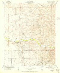
1954 Map of North of Oildale
USGS Topo · Published 1955About this map
Oil industry infrastructure dominates this mid-century landscape north of Bakersfield, where the Premier Oil Field, Mc Van Oil Field, and Kern Front Oil Field reveal a complex network of Pipe Lines and derricks. The terrain is defined by the winding course of Poso Creek and Little Poso Creek, which cut through the hills near Mt Poso. A notable institutional presence is found at the Kern County Industrial Farm in the southwest corner, positioned near a large reservoir. The map captures a transitional period in local water management, evidenced by a Diversion Dam on Poso Creek and a nearby Abandoned Canal, reflecting the ongoing modification of the arid Kern County environment for industrial and agricultural use.
Find a feature on this map
18 named features on this map. Tap any name to fly to it.
Don’t see what you’re looking for? This feature index may not catch every label — zoom into the map to look around manually.
Map Details
Editions of this 1954 North of Oildale Map
3 editions found
Other maps of this area

1906 · Bakersfield
USGS Topo · 1:62,500

1910 · Buena Vista Lake
USGS Topo · 1:125,000

1912 · Buena Vista Lake
USGS Topo · 1:125,000

1914 · Caliente
USGS Topo · 1:125,000

1927 · McFarland
USGS Topo · 1:31,680

1930 · McFarland
USGS Topo · 1:31,680

1930 · Famoso
USGS Topo · 1:31,680

1930 · Rosedale
USGS Topo · 1:31,680

1930 · Oildale
USGS Topo · 1:31,680

1931 · Deepwell Ranch
USGS Topo · 1:31,680