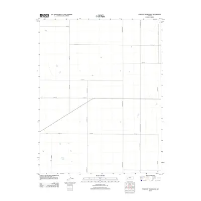
2012 Map of North of Pierceville
USGS Topo · Published 2012About this map
North of Pierceville, Kansas, the landscape is defined by the rigid geometry of high-plains agriculture and its supporting road network. This 2012 survey by the U.S. Geological Survey shows a sparse but organized territory where family-named thoroughfares such as Linville Rd and E Martin Rd divide the open country. The orientation of the map reveals the cultural and community foundations of this part of Finney County, most notably through N Mennonite Rd and N Little Mennonite Rd, which point to the area's local heritage and settlement patterns.
Find a feature on this map
15 named features on this map. Tap any name to fly to it.
Don’t see what you’re looking for? This feature index may not catch every label — zoom into the map to look around manually.
Map Details
Editions of this 2012 North of Pierceville Map
This is the sole edition of this map. No revisions or reprints were ever made.
Other maps of this area

1896 · Garden
USGS Topo · 1:125,000

1944 · Tennis
USGS Topo · 1:62,500

1955 · Dodge City
USGS Topo · 1:250,000

1955 · Scott City
USGS Topo · 1:250,000

1958 · Dodge City
USGS Topo · 1:250,000

1958 · Scott City
USGS Topo · 1:250,000

1959 · Dodge City
USGS Topo · 1:250,000

1960 · Garden City East
USGS Topo · 1:24,000

1967 · Pierceville
USGS Topo · 1:24,000
1968 · Pierceville NE
USGS Topo · 1:24,000