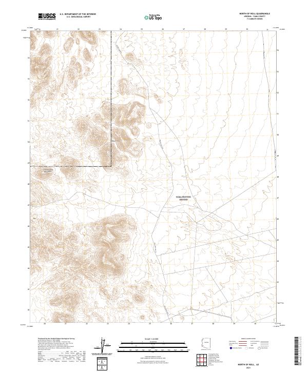
2021 Map of North of Roll
USGS Topo · Published 2021About this map
The arid desert floor of Yuma County rises sharply into the Castle Dome Mountains in this modern topographic study. The landscape is defined by the stark transition from flat desert basins to the craggy elevations of the Black Hills, illustrating the dramatic basin-and-range topography typical of the region. The primary human imprint on this wilderness area is Wellton Kofa Rd, a long north-south corridor that provides the only significant access through these remote sections of public land. This 2021 edition serves as a precise baseline for understanding current land use and accessibility in a part of Arizona where natural geography still dictates movement and activity.
Find a feature on this map
7 named features on this map. Tap any name to fly to it.
Don’t see what you’re looking for? This feature index may not catch every label — zoom into the map to look around manually.
Map Details
Editions of this 2021 North of Roll Map
This is the sole edition of this map. No revisions or reprints were ever made.
Other maps of this area

1928 · Norton
USGS Topo · 1:62,500

1929 · Norton
USGS Topo · 1:62,500

1942 · Yuma
USGS Topo · 1:250,000

1942 · Blythe
USGS Topo · 1:250,000

1942 · Vicksburg
USGS Topo · 1:250,000

1953 · Ajo
USGS Topo · 1:250,000

1954 · El Centro
USGS Topo · 1:250,000

1954 · Salton Sea
USGS Topo · 1:250,000

1954 · Phoenix
USGS Topo · 1:250,000

1955 · Salton Sea
USGS Topo · 1:250,000