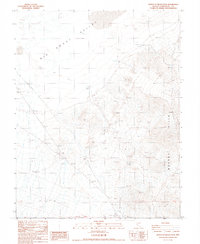
1987 Map of North of Silver Peak
USGS Topo · Published 1987About this map
Big Smoky Valley dominates the western portion of this Great Basin landscape, characterized by the expansive Alkali Flat and intermittent drainage patterns. To the east, the Weepah Hills rise sharply, marked by an intensive history of mineral exploration indicated by numerous Prospects and the Alum Mine. Evidence of early industrial infrastructure is visible in the abandoned Railroad Grade that skirts the valley floor, alongside isolated outposts like Minnesota Well and Alum Well. This 1987 revision of earlier surveys preserves the location of Ruins and dry Waterfalls, providing a detailed record of the desert's physical and human geography during the late twentieth century. The map effectively captures the intersection of natural geologic features, such as the Monocline, with the sparse but significant traces of human activity in Esmeralda County.
Find a feature on this map
19 named features on this map. Tap any name to fly to it.
Don’t see what you’re looking for? This feature index may not catch every label — zoom into the map to look around manually.
Map Details
Editions of this 1987 North of Silver Peak Map
This is the sole edition of this map. No revisions or reprints were ever made.
Other maps of this area

1898 · Silver Peak
USGS Topo · 1:125,000

1900 · Silver Peak
USGS Topo · 1:125,000

1907 · Tonopah
USGS Topo · 1:250,000

1908 · Lida
USGS Topo · 1:250,000

1908 · Tonopah
USGS Topo · 1:250,000

1913 · Lida
USGS Topo · 1:250,000

1954 · Goldfield
USGS Topo · 1:250,000

1955 · Goldfield
USGS Topo · 1:250,000

1956 · Tonopah
USGS Topo · 1:250,000

1958 · Goldfield
USGS Topo · 1:250,000