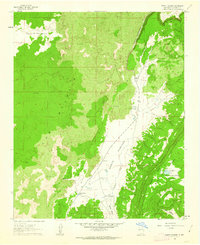
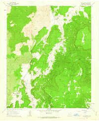
1961 Map of North Pasture
USGS Topo · Published 1963About this map
Volcanic geology dominates the landscape shown in this 1961 survey, where the expanse of The Malpais flows across the western half of the quadrangle. This hardened lava field meets the vertical rise of Cebolleta Mesa at a dramatic passage known as The Narrows. Along this corridor, State Route 117 follows the drainage of Cebolla Creek through the North Pasture, providing a thin line of transit through the otherwise formidable terrain.
Find a feature on this map
19 named features on this map. Tap any name to fly to it.
Don’t see what you’re looking for? This feature index may not catch every label — zoom into the map to look around manually.
Map Details
Editions of this 1961 North Pasture Map
2 editions found
Other maps of this area

1917 · Broom Mountain
USGS Topo · 1:125,000

1954 · Saint Johns
USGS Topo · 1:250,000

1954 · Socorro
USGS Topo · 1:250,000

1957 · Saint Johns
USGS Topo · 1:250,000

1958 · Socorro
USGS Topo · 1:250,000

1958 · Saint Johns
USGS Topo · 1:250,000
1961 · Arrosa Ranch
USGS Topo · 1:24,000
1961 · Laguna Honda
USGS Topo · 1:24,000
1961 · Los Pilares
USGS Topo · 1:24,000

1962 · Socorro
USGS Topo · 1:250,000