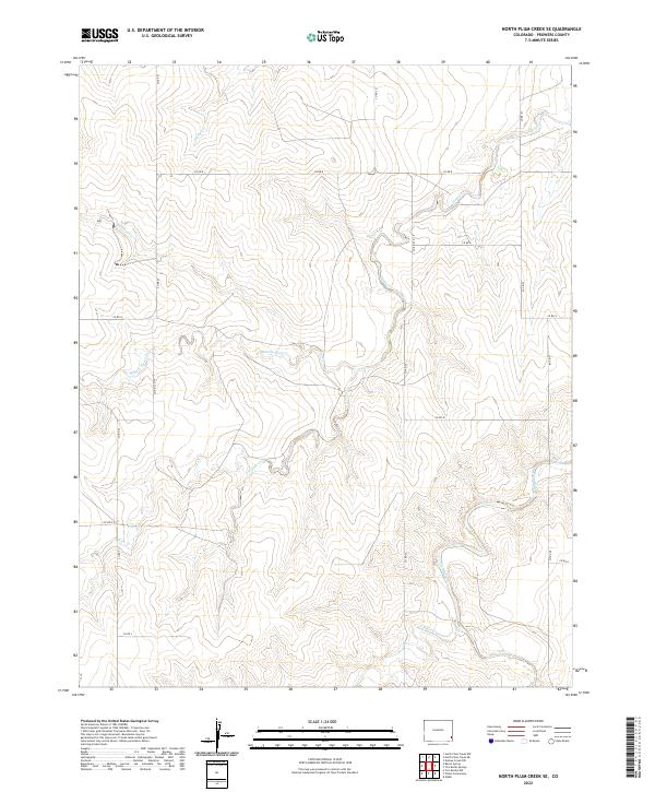
2022 Map of North Plum Creek SE
USGS Topo · Published 2022About this map
Plum Creek and its many seasonal tributaries define the landscape of this southeastern Colorado plateau in Prowers County. The map details a complex drainage network where Durkee Creek and North Plum Creek converge in the north, while the southern reaches are marked by the presence of South Plum Creek and Middle Plum Creek. These intermittent waterways have carved deep undulations into the terrain, a characteristic typical of the high plains before they descend toward the river valleys. A strict grid of county roads, such as County Road 22 and County Road R, partitions the land into large ranching or agricultural sections, illustrating the persistent influence of the Public Land Survey System. The map also captures the path of Two Butte Creek and North Butte Creek as they traverse the southern edge of this quadrangle.
Find a feature on this map
25 named features on this map. Tap any name to fly to it.
Don’t see what you’re looking for? This feature index may not catch every label — zoom into the map to look around manually.
Map Details
Editions of this 2022 North Plum Creek SE Map
This is the sole edition of this map. No revisions or reprints were ever made.
Other maps of this area

1891 · Albany
USGS Topo · 1:125,000

1893 · Albany
USGS Topo · 1:125,000

1955 · La Junta
USGS Topo · 1:250,000

1958 · La Junta
USGS Topo · 1:250,000
1966 · Two Butte Springs
USGS Topo · 1:24,000
1966 · Durkee Creek NW
USGS Topo · 1:24,000

1968 · La Junta
USGS Topo · 1:250,000
1968 · North Plum Creek NE
USGS Topo · 1:24,000
1968 · North Plum Creek SE
USGS Topo · 1:24,000
1968 · North Plum Creek NW
USGS Topo · 1:24,000