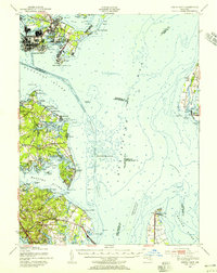
1947 Map of North Point
USGS Topo · Published 1955About this map
Industrial Sparrows Point dominates the northwestern corner of this Chesapeake Bay survey, showing a landscape defined by steel production and strategic maritime navigation just after World War II. The map details the complex dredging of the Brewerton Channel and Cutoff Channel, essential for the deep-draft vessels serving the Bethlehem Steel works. Shoreline communities such as Lodge Forest and Edgemere appear near the military installations at Fort Howard.
Find a feature on this map
85 named features on this map. Tap any name to fly to it.
Don’t see what you’re looking for? This feature index may not catch every label — zoom into the map to look around manually.
Map Details
Editions of this 1947 North Point Map
This is the sole edition of this map. No revisions or reprints were ever made.
Other maps of this area

1892 · Owensville
USGS Topo · 1:62,500

1892 · Annapolis
USGS Topo · 1:62,500

1893 · North Point
USGS Topo · 1:62,500

1893 · Gunpowder
USGS Topo · 1:62,500

1894 · Baltimore
USGS Topo · 1:62,500

1894 · Relay
USGS Topo · 1:62,500

1895 · Owensville
USGS Topo · 1:62,500

1898 · Choptank
USGS Topo · 1:125,000

1898 · Tolchester
USGS Topo · 1:125,000

1899 · Patuxent
USGS Topo · 1:125,000