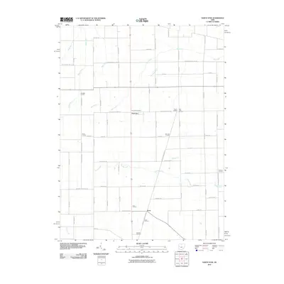
2010 Map of North Star
USGS Topo · Published 2010About this map
North Star and the nearby village of Brock sit at the center of a dense agricultural landscape on the border of Darke and Mercer counties. This rural landscape is defined by its meticulous grid of section-line roads and a drainage network including the Wabash River, Mile Creek, and Bear Creek. The map reveals a high concentration of small family and community burial grounds, such as Holsapple Cemetery, Shook Cemetery, and Teacup Cemetery, providing significant evidence of early settlement patterns and genealogical history in this part of western Ohio.
Find a feature on this map
40 named features on this map. Tap any name to fly to it.
Don’t see what you’re looking for? This feature index may not catch every label — zoom into the map to look around manually.
Map Details
Editions of this 2010 North Star Map
This is the sole edition of this map. No revisions or reprints were ever made.
Other maps of this area

1908 · St. Henry
USGS Topo · 1:62,500

1909 · Loramie
USGS Topo · 1:62,500

1911 · Loramie
USGS Topo · 1:62,500

1911 · Covington
USGS Topo · 1:62,500

1944 · Covington
USGS Topo · 1:62,500

1944 · Loramie
USGS Topo · 1:62,500

1953 · Muncie
USGS Topo · 1:250,000

1956 · Muncie
USGS Topo · 1:250,000

1961 · Dawn
USGS Topo · 1:24,000
1961 · Rossburg
USGS Topo · 1:24,000