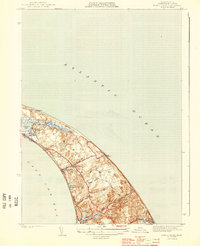
1944 Map of North Truro
USGS Topo · Published 1944About this map
Cape Cod Lighthouse stands as a sentinel on The Highlands in this mid-century survey of the Outer Cape. The landscape is defined by the narrow, wind-swept stretch between Cape Cod Bay and the open Atlantic Ocean, where coastal geography shaped the early settlements of North Truro and Pond Village. Notable for genealogists, the map identifies the Old North Cem and Truro Central Sch alongside local landmarks like Pilgrim Heights and Pilgrim Spring.
Find a feature on this map
27 named features on this map. Tap any name to fly to it.
Don’t see what you’re looking for? This feature index may not catch every label — zoom into the map to look around manually.
Map Details
Editions of this 1944 North Truro Map
4 editions found
Other maps of this area

1887 · Wellfleet
USGS Topo · 1:62,500

1887 · Provincetown
USGS Topo · 1:62,500

1889 · Provincetown
USGS Topo · 1:62,500

1889 · Wellfleet
USGS Topo · 1:62,500

1893 · Wellfleet
USGS Topo · 1:62,500

1898 · Provincetown
USGS Topo · 1:62,500

1942 · Cape Cod Bay
USGS Topo · 1:125,000

1942 · Nauset
USGS Topo · 1:125,000

1944 · Provincetown
USGS Topo · 1:31,680

1944 · Wellfleet
USGS Topo · 1:31,680