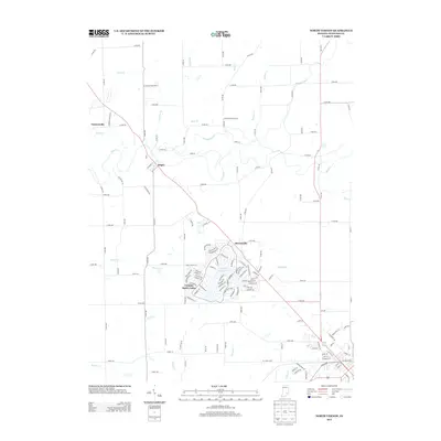
2013 Map of North Vernon
USGS Topo · Published 2013About this map
The residential development at Country Squire Lakes dominates the center of this 2013 Jennings County survey, showing a dense network of suburban-style streets in contrast to the surrounding rural landscape. To the north and west, the smaller settlements of Scipio, Queensville, and Tannersville are situated along the primary corridors, marking historic crossroads in this part of southern Indiana. The terrain is defined by a dendritic drainage system, where Sand Creek and its many tributaries, including Wyaloosing Creek, Mutton Creek, and Bear Creek, carve through the countryside. This map illustrates the transition from traditional agricultural land use to more concentrated modern communities, particularly around the lake-centered neighborhood south of Queensville, while maintaining the essential grid of county roads such as County Road 700 and County Road 400.
Find a feature on this map
132 named features on this map. Tap any name to fly to it.
Don’t see what you’re looking for? This feature index may not catch every label — zoom into the map to look around manually.
Map Details
Editions of this 2013 North Vernon Map
This is the sole edition of this map. No revisions or reprints were ever made.
Other maps of this area

1942 · Columbus
USGS Topo · 1:125,000

1953 · Cincinnati
USGS Topo · 1:250,000

1956 · Louisville
USGS Topo · 1:250,000

1957 · Cincinnati
USGS Topo · 1:250,000

1957 · Butlerville
USGS Topo · 1:24,000

1957 · Azalia
USGS Topo · 1:24,000

1957 · North Vernon
USGS Topo · 1:24,000

1958 · Westport
USGS Topo · 1:24,000

1958 · Grammer
USGS Topo · 1:24,000
1958 · Elizabethtown
USGS Topo · 1:24,000