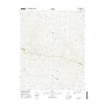
2016 Map of North View
USGS Topo · Published 2016About this map
Meherrin River serves as the winding divider between Lunenburg and Mecklenburg counties, defining the rural character of this Piedmont landscape. The 2016 survey documents a region defined by agricultural traditions and historic crossroads settlements. At the center of the sheet, the river crossing at Saffolds Bridge connects northern areas like Ogburn and Bagleys Mills with the southern communities of Chalk Level and Pleasant Grove.
Find a feature on this map
60 named features on this map. Tap any name to fly to it.
Don’t see what you’re looking for? This feature index may not catch every label — zoom into the map to look around manually.
Map Details
Editions of this 2016 North View Map
This is the sole edition of this map. No revisions or reprints were ever made.
Other maps of this area

1953 · Greensboro
USGS Topo · 1:250,000

1954 · Greensboro
USGS Topo · 1:250,000

1955 · Chase City
USGS Topo · 1:62,500

1955 · Kenbridge
USGS Topo · 1:62,500

1955 · Boydton
USGS Topo · 1:62,500

1962 · Greensboro
USGS Topo · 1:250,000

1966 · Greensboro
USGS Topo · 1:250,000
1966 · Wightman
USGS Topo · 1:24,000
1966 · North View
USGS Topo · 1:24,000
1966 · Lunenburg
USGS Topo · 1:24,000