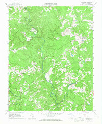
1966 Map of Lunenburg
USGS Topo · Published 1967About this map
Lunenburg serves as a focal point for this rural landscape in the mid-1960s, where the winding courses of the North Meherrin River and Middle Meherrin River dictate the local geography. The map reveals a community defined by its proximity to water and religious life, with numerous small settlements like Rehoboth, Wattsboro, and Traffic distributed across the terrain. A notable density of country churches, including Tussekiah Ch, Bethany Ch, and Mt Olivet Ch, suggests a traditional settlement pattern where these institutions served as primary social anchors.
Find a feature on this map
23 named features on this map. Tap any name to fly to it.
Don’t see what you’re looking for? This feature index may not catch every label — zoom into the map to look around manually.
Map Details
Editions of this 1966 Lunenburg Map
Other maps of this area

1891 · Farmville
USGS Topo · 1:125,000

1893 · Farmville
USGS Topo · 1:125,000

1947 · Roanoke
USGS Topo · 1:250,000

1953 · Greensboro
USGS Topo · 1:250,000

1954 · Greensboro
USGS Topo · 1:250,000

1955 · Chase City
USGS Topo · 1:62,500

1955 · Kenbridge
USGS Topo · 1:62,500

1958 · Crewe
USGS Topo · 1:62,500

1958 · Keysville
USGS Topo · 1:62,500

1959 · Roanoke
USGS Topo · 1:250,000