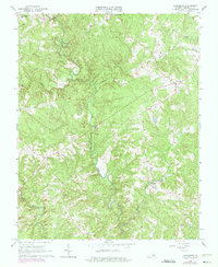
1966 Map of Lunenburg
USGS Topo · Published 1975About this map
The North Meherrin River and Middle Meherrin River define the winding drainage patterns of this south-central Virginia landscape during the mid-1960s. Rural life is anchored by a network of crossroads settlements and country churches, including Lunenburg, Rehoboth, and Wattsboro. The terrain is deeply dissected by numerous creeks such as Hurricane Creek, Juniper Creek, and Reedy Creek, which influenced the placement of early infrastructure like Loves Mill.
Find a feature on this map
23 named features on this map. Tap any name to fly to it.
Don’t see what you’re looking for? This feature index may not catch every label — zoom into the map to look around manually.
Map Details
Editions of this 1966 Lunenburg Map
Other maps of this area

1891 · Farmville
USGS Topo · 1:125,000

1893 · Farmville
USGS Topo · 1:125,000

1947 · Roanoke
USGS Topo · 1:250,000

1953 · Greensboro
USGS Topo · 1:250,000

1954 · Greensboro
USGS Topo · 1:250,000

1955 · Chase City
USGS Topo · 1:62,500

1955 · Kenbridge
USGS Topo · 1:62,500

1958 · Crewe
USGS Topo · 1:62,500

1958 · Keysville
USGS Topo · 1:62,500

1959 · Roanoke
USGS Topo · 1:250,000