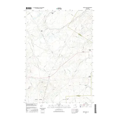
2016 Map of North Wilna
USGS Topo · Published 2016About this map
Fort Drum dominates the central landscape of this Jefferson County territory, where military training grounds meet the rural settlements of the Indian River valley. The map documents a complex network of tactical routes like Tank Trl and US Military Hwy alongside older civilian thoroughfares such as Russell Tpke and Mullin Settlement Rd. In the north, the Indian River winds past Woods Mill and North Wilna, while the settlement of Natural Bridge sits near the eastern boundary, marked by the Natural Bridge Cem.
Find a feature on this map
60 named features on this map. Tap any name to fly to it.
Don’t see what you’re looking for? This feature index may not catch every label — zoom into the map to look around manually.
Map Details
Editions of this 2016 North Wilna Map
This is the sole edition of this map. No revisions or reprints were ever made.
Other maps of this area

1902 · Carthage
USGS Topo · 1:62,500

1904 · Carthage
USGS Topo · 1:62,500

1911 · Antwerp
USGS Topo · 1:62,500

1911 · Lowville
USGS Topo · 1:62,500

1913 · Lowville
USGS Topo · 1:62,500

1913 · Lake Bonaparte
USGS Topo · 1:62,500

1916 · Lake Bonaparte
USGS Topo · 1:62,500

1942 · Copenhagen
USGS Topo · 1:24,000

1943 · Copenhagen
USGS Topo · 1:31,680

1943 · Carthage
USGS Topo · 1:31,680