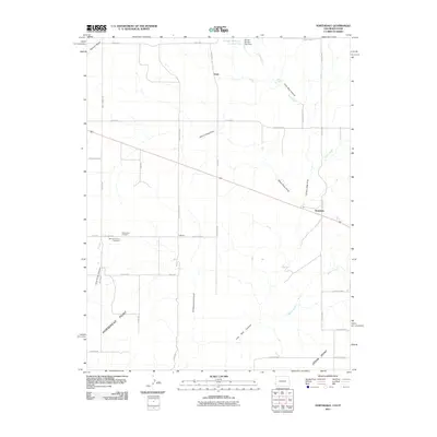
2011 Map of Northdale
USGS Topo · Published 2011About this map
Mountain View Cemetery and Valley View Cemetery sit near the border of Utah and Colorado, serving the small agricultural and ranching communities of the high desert plateau. In the early 21st century, the landscape is defined by its deep drainages and intermittent water sources, such as Piute Creek and the Snyder Reservoir Number Two. The settlement pattern follows a grid of county roads that navigate between significant geographic features like Horsehead Point and Cedar Point.
Find a feature on this map
39 named features on this map. Tap any name to fly to it.
Don’t see what you’re looking for? This feature index may not catch every label — zoom into the map to look around manually.
Map Details
Editions of this 2011 Northdale Map
This is the sole edition of this map. No revisions or reprints were ever made.
Other maps of this area

1886 · Abajo
USGS Topo · 1:250,000

1892 · Abajo
USGS Topo · 1:250,000

1893 · Abajo
USGS Topo · 1:250,000

1949 · Egnar
USGS Topo · 1:24,000

1950 · Egnar
USGS Topo · 1:24,000

1955 · Verdure 4 NW
USGS Topo · 1:24,000

1955 · Verdure 1 SW
USGS Topo · 1:24,000

1956 · Cortez
USGS Topo · 1:250,000

1957 · Cedar 3 NW
USGS Topo · 1:24,000

1957 · Monument Canyon
USGS Topo · 1:62,500