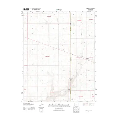
2013 Map of Northdale
USGS Topo · Published 2013About this map
The Utah-Colorado state line bisects this high-plateau landscape, where the settlement of Northdale sits near the intersection of Us-491 N and CO Road 2. The terrain is defined by dramatic drainage systems, including the deep incision of Coal Bed Canyon in the south and the winding path of Willow Creek. Ranching and agricultural infrastructure dominate the eastern half, marked by a systematic grid of county roads like CO Road A and CO Road G. Water sources are critical in this arid environment, represented by landmarks such as Irwin Spring and Piute Creek. The map provides a look at the land division system across the San Juan and Dolores county line, illustrating the intersection of natural topography like Cedar Point and White Flats Draw with the modern transportation network.
Find a feature on this map
30 named features on this map. Tap any name to fly to it.
Don’t see what you’re looking for? This feature index may not catch every label — zoom into the map to look around manually.
Map Details
Editions of this 2013 Northdale Map
This is the sole edition of this map. No revisions or reprints were ever made.
Other maps of this area

1886 · Abajo
USGS Topo · 1:250,000

1892 · Abajo
USGS Topo · 1:250,000

1893 · Abajo
USGS Topo · 1:250,000

1949 · Egnar
USGS Topo · 1:24,000

1950 · Egnar
USGS Topo · 1:24,000

1955 · Verdure 4 NW
USGS Topo · 1:24,000

1955 · Verdure 1 SW
USGS Topo · 1:24,000

1956 · Cortez
USGS Topo · 1:250,000

1957 · Cedar 3 NW
USGS Topo · 1:24,000

1957 · Monument Canyon
USGS Topo · 1:62,500