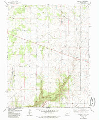
1985 Map of Northdale
USGS Topo · Published 1985About this map
The Utah Colorado border dissects this high plateau landscape, where high-altitude farming and ranching meet deep canyon drainage systems. Small settlements like Northdale and Ucolo anchor the rural infrastructure of the mid-1980s, joined by the named locale of Lockerby. The terrain is defined by dramatic elevation shifts, particularly where the level expanses of White Flats give way to the steep descent into Coal Bed Canyon and Cottonwood Canyon. Family-history researchers may find interest in the Mountain View Cem located near the western edge of the quadrangle. The map also records the utilitarian nature of the era's land use, noting Storage Bins and scattered Drill Holes, alongside recreational markers like the Roadside Park along the primary roadway crossing into San Juan County.
Find a feature on this map
22 named features on this map. Tap any name to fly to it.
Don’t see what you’re looking for? This feature index may not catch every label — zoom into the map to look around manually.
Map Details
Editions of this 1985 Northdale Map
This is the sole edition of this map. No revisions or reprints were ever made.
Other maps of this area

1886 · Abajo
USGS Topo · 1:250,000

1892 · Abajo
USGS Topo · 1:250,000

1893 · Abajo
USGS Topo · 1:250,000

1949 · Egnar
USGS Topo · 1:24,000

1950 · Egnar
USGS Topo · 1:24,000

1955 · Verdure 4 NW
USGS Topo · 1:24,000

1955 · Verdure 1 SW
USGS Topo · 1:24,000

1956 · Cortez
USGS Topo · 1:250,000

1957 · Cedar 3 NW
USGS Topo · 1:24,000

1957 · Monument Canyon
USGS Topo · 1:62,500