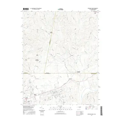
2016 Map of Northeast Eden
USGS Topo · Published 2016About this map
The Eden city limits and the industrial corridor at Leaksville Junction define the southern portion of this border-crossing survey. Straddling the line between North Carolina and Virginia, the landscape transitions from the urbanized Central Area of Eden toward the rural uplands of Pittsylvania and Henry Counties. Waterways like the Dan River and Smith River provide the primary geographic structure, joined by numerous tributaries such as Cascade Creek and Mountain Run.
Find a feature on this map
147 named features on this map. Tap any name to fly to it.
Don’t see what you’re looking for? This feature index may not catch every label — zoom into the map to look around manually.
Map Details
Editions of this 2016 Northeast Eden Map
This is the sole edition of this map. No revisions or reprints were ever made.
Other maps of this area

1924 · Martinsville
USGS Topo · 1:48,000

1924 · Draper
USGS Topo · 1:48,000

1926 · Martinsville
USGS Topo · 1:62,500

1926 · Draper
USGS Topo · 1:62,500

1927 · Martinsville
USGS Topo · 1:62,500

1944 · Martinsville
USGS Topo · 1:62,500

1944 · Draper
USGS Topo · 1:62,500

1953 · Greensboro
USGS Topo · 1:250,000

1954 · Greensboro
USGS Topo · 1:250,000

1962 · Greensboro
USGS Topo · 1:250,000