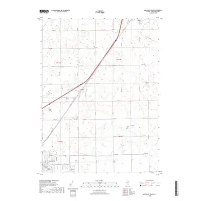
2018 Map of Northeast Pontiac
USGS Topo · Published 2018About this map
The city of Pontiac serves as the focal point of this Livingston County landscape, situated at the southwestern edge of a grid-iron agricultural network. This 2018 survey reveals a territory deeply influenced by the historic corridor of Old US Hwy 66 and Old Rte 66, which bisect the terrain diagonally, connecting the smaller settlements of Cayuga and Odell. Aviation interests are represented by both the Pontiac Municipal Airport and the smaller Schott Airport, while the rural outskirts are punctuated by long-established sites of local memory such as Memorial Park Cem and Swygert Cem. Numerous watercourses, including Wolf Cr and Smith Br, weave through the townships, indicating the natural drainage patterns of this central Illinois prairie land. The intersection of modern infrastructure and legacy routes like S West St provides a clear view of the area's continued role as a regional transportation hub.
Find a feature on this map
40 named features on this map. Tap any name to fly to it.
Don’t see what you’re looking for? This feature index may not catch every label — zoom into the map to look around manually.
Map Details
Editions of this 2018 Northeast Pontiac Map
This is the sole edition of this map. No revisions or reprints were ever made.
Other maps of this area

1935 · Pontiac
USGS Topo · 1:62,500

1939 · Pontiac
USGS Topo · 1:62,500

1947 · Cullom
USGS Topo · 1:62,500

1948 · Dwight
USGS Topo · 1:62,500

1949 · Cullom
USGS Topo · 1:62,500

1950 · Dwight
USGS Topo · 1:62,500

1958 · Odell
USGS Topo · 1:62,500

1958 · Aurora
USGS Topo · 1:250,000

1958 · Peoria
USGS Topo · 1:250,000

1961 · Aurora
USGS Topo · 1:250,000