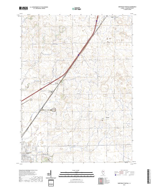
2024 Map of Northeast Pontiac
USGS Topo · Published 2024About this map
Pontiac and its surrounding northern agricultural lands are documented here, anchored by the transportation corridor that includes Interstate 55 and the historic path of Old Route 66. The landscape is defined by the grid-like township and range roads that crisscross the prairie, interspersed with small settlements like Cayuga, Odell, and Swygert. Water features such as Wolf Creek, Smith Branch, and North Creek weave through the fields, providing a natural contrast to the industrial and municipal growth near the Pontiac Municipal Airport. Genealogists will find interest in the documented locations of local burial grounds, including Saint Marys Cem, Memorial Park Cem, and Swygert Cem. This survey illustrates the modern evolution of the Livingston County countryside, where high-speed transit routes now parallel the legendary Mother Road and historical village sites.
Find a feature on this map
59 named features on this map. Tap any name to fly to it.
Don’t see what you’re looking for? This feature index may not catch every label — zoom into the map to look around manually.
Map Details
Editions of this 2024 Northeast Pontiac Map
This is the sole edition of this map. No revisions or reprints were ever made.
Other maps of this area

1935 · Pontiac
USGS Topo · 1:62,500

1939 · Pontiac
USGS Topo · 1:62,500

1947 · Cullom
USGS Topo · 1:62,500

1948 · Dwight
USGS Topo · 1:62,500

1949 · Cullom
USGS Topo · 1:62,500

1950 · Dwight
USGS Topo · 1:62,500

1958 · Odell
USGS Topo · 1:62,500

1958 · Aurora
USGS Topo · 1:250,000

1958 · Peoria
USGS Topo · 1:250,000

1961 · Aurora
USGS Topo · 1:250,000