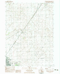
1983 Map of Northeast Pontiac
USGS Topo · Published 1983About this map
The agricultural landscape of Livingston County is anchored by the city of Pontiac in the southwest and the village of Odell in the northeast, connected by the diagonal corridor of the Illinois Central Gulf railroad. This survey captures a rural network of small grain-handling points and vanished crossroads such as Cayuga and Swygert. The terrain is characterized by the drainage of Deer Creek, Wolf Creek, and the North Fork Vermilion River, with local industry marked by a substantial Limestone Quarry and the Schott Landing Strip. For local historians, the map preserves the locations of several rural education and religious sites, including the Owego Sch and the Calvary Ch and cemetery complex. The transition from town to country is evident in the cluster of parks and schools on the outskirts of Pontiac, including Washington Sch and High Sch.
Find a feature on this map
33 named features on this map. Tap any name to fly to it.
Don’t see what you’re looking for? This feature index may not catch every label — zoom into the map to look around manually.
Map Details
Editions of this 1983 Northeast Pontiac Map
This is the sole edition of this map. No revisions or reprints were ever made.
Other maps of this area

1935 · Pontiac
USGS Topo · 1:62,500

1939 · Pontiac
USGS Topo · 1:62,500

1947 · Cullom
USGS Topo · 1:62,500

1948 · Dwight
USGS Topo · 1:62,500

1949 · Cullom
USGS Topo · 1:62,500

1950 · Dwight
USGS Topo · 1:62,500

1958 · Odell
USGS Topo · 1:62,500

1958 · Aurora
USGS Topo · 1:250,000

1958 · Peoria
USGS Topo · 1:250,000

1961 · Aurora
USGS Topo · 1:250,000