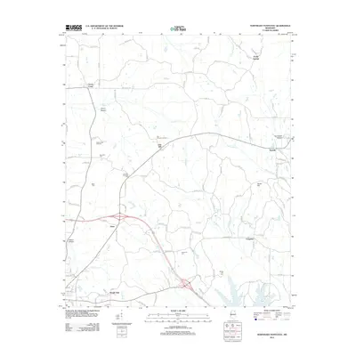
2012 Map of Northeast Pontotoc
USGS Topo · Published 2012About this map
Oak Hill Lookout Tower stands as a prominent landmark in this section of Northeast Mississippi, overlooking a landscape defined by small rural settlements and a network of county roads. The area around Oak Hill and Cherry Creek reflects a quiet, agrarian character, punctuated by several community focal points including Cherry Creek Orchards and Pontotoc Memorial Park. Genealogists and local researchers will find value in the documentation of several family and community burial sites, such as Harmony Cem, Miller Cem, and Spring Hill Cem.
Find a feature on this map
113 named features on this map. Tap any name to fly to it.
Don’t see what you’re looking for? This feature index may not catch every label — zoom into the map to look around manually.
Map Details
Editions of this 2012 Northeast Pontotoc Map
This is the sole edition of this map. No revisions or reprints were ever made.
Other maps of this area

1949 · New Albany
USGS Topo · 1:62,500

1951 · New Albany
USGS Topo · 1:62,500

1955 · Sherman
USGS Topo · 1:62,500

1956 · Tupelo
USGS Topo · 1:250,000

1958 · Tupelo
USGS Topo · 1:250,000

1966 · Troy NW
USGS Topo · 1:24,000

1966 · Bissell
USGS Topo · 1:24,000
1972 · Southwest Pontotoc
USGS Topo · 1:24,000

1980 · Northwest Pontotoc
USGS Topo · 1:24,000

1980 · New Albany West
USGS Topo · 1:24,000