
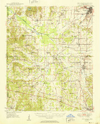
1951 Map of New Albany
USGS Topo · Published 1951About this map
The Gulf Mobile And Ohio railroad anchors the local economy of this North Mississippi landscape, connecting the county seat at New Albany to southern settlements like Ecru and North Junction. This mid-century survey reveals a deeply established network of rural community centers, defined by dozens of family and church landmarks such as McGregor Chapel, Stewarts Chapel, and Possum Trot. The winding Tallahatchie River and its many tributaries, including Hell Creek and Lappatubby Creek, dictate the placement of early roads and small farming hamlets like Flatwood and Pinedale. Genealogists will find significant detail in the distribution of schools and churches, from St Marys Sch near the Fish Hatchery to the Beulah Grove Sch further south. The map captures the region before modern highway expansions significantly altered the traditional township lines and property boundaries between Union, Pontotoc, and Lafayette counties.
Find a feature on this map
79 named features on this map. Tap any name to fly to it.
Don’t see what you’re looking for? This feature index may not catch every label — zoom into the map to look around manually.
Map Details
Editions of this 1951 New Albany Map
2 editions found
Other maps of this area

1942 · Denmark
USGS Topo · 1:62,500

1943 · Denmark
USGS Topo · 1:62,500

1944 · Potts Camp
USGS Topo · 1:62,500

1945 · Potts Camp
USGS Topo · 1:62,500

1949 · New Albany
USGS Topo · 1:62,500

1955 · Ripley
USGS Topo · 1:62,500

1955 · Sherman
USGS Topo · 1:62,500

1955 · Blue Mountain
USGS Topo · 1:62,500

1956 · Tupelo
USGS Topo · 1:250,000

1958 · Tupelo
USGS Topo · 1:250,000