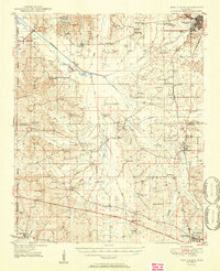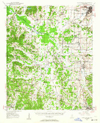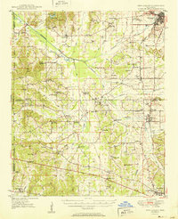
1951 Map of New Albany
USGS Topo · Published 1951About this map
New Albany serves as the focal point of this northern Mississippi landscape, where the Gulf Mobile and Ohio railroad intersects the upper reaches of the Tallahatchie River. The area is characterized by a dense network of rural communities and crossroads, many defined by local institutions like St Marys Sch, Shady Grove Ch, and McGregor Chapel. In the western portion, the terrain transitions into the Holly Springs National Forest, while the eastern side features established settlements such as Ecru and Ingomar. This survey captures the region prior to extensive highway modernization, showing traditional land patterns and local landmarks including the Fish Hatchery and numerous family-named cemeteries like Pleasant Grove Cem. Localized place names like Possum Trot and Buttermilk Creek reflect the deep cultural roots and rural character of Union and Pontotoc counties during the mid-century era.
Find a feature on this map
75 named features on this map. Tap any name to fly to it.
Don’t see what you’re looking for? This feature index may not catch every label — zoom into the map to look around manually.
Map Details
Editions of this 1951 New Albany Map
2 editions found