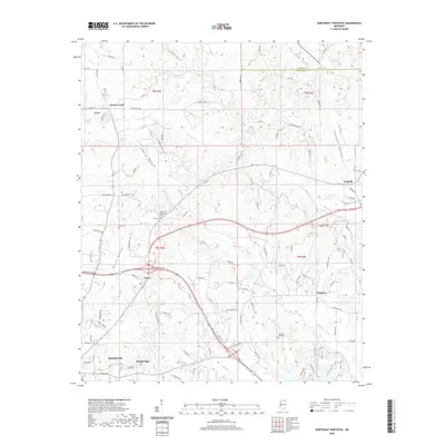
2020 Map of Northeast Pontotoc
USGS Topo · Published 2020About this map
The northern reaches of Pontotoc extend toward the rural communities of Ecru and Nixon, where the landscape is defined by broad alluvial basins like Cherry Bottom and Wilson Bottom. These low-lying areas, drained by waterways such as Cherry Cr and Miller Cr, contrast with the surrounding elevations like Dozier Hill. The road network connects historically distinct clusters, including the small settlement of Endville to the east and Cherry Creek to the north, reflecting a long-standing pattern of dispersed agricultural hamlets across this portion of Pontotoc County.
Find a feature on this map
113 named features on this map. Tap any name to fly to it.
Don’t see what you’re looking for? This feature index may not catch every label — zoom into the map to look around manually.
Map Details
Editions of this 2020 Northeast Pontotoc Map
This is the sole edition of this map. No revisions or reprints were ever made.
Other maps of this area

1949 · New Albany
USGS Topo · 1:62,500

1951 · New Albany
USGS Topo · 1:62,500

1955 · Sherman
USGS Topo · 1:62,500

1956 · Tupelo
USGS Topo · 1:250,000

1958 · Tupelo
USGS Topo · 1:250,000

1966 · Troy NW
USGS Topo · 1:24,000

1966 · Bissell
USGS Topo · 1:24,000
1972 · Southwest Pontotoc
USGS Topo · 1:24,000

1980 · Northwest Pontotoc
USGS Topo · 1:24,000

1980 · New Albany West
USGS Topo · 1:24,000