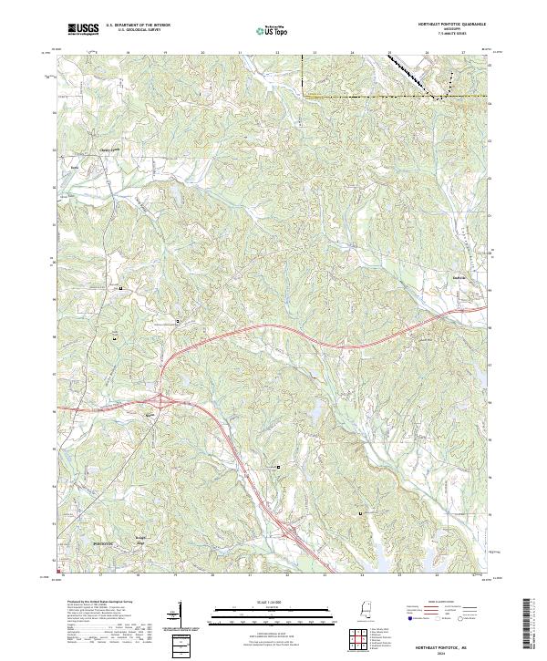
2024 Map of Northeast Pontotoc
USGS Topo · Published 2024About this map
The Union and Pontotoc county line cuts through a landscape defined by rolling terrain and a dense network of creek bottoms. In the northern reaches, the community of Ecru and the settlement of Cherry Creek sit near the broad Cherry Bottom drainage. The map captures a mix of small crossroads and rural centers, from Endville in the east to the residential clusters of Nixon and Rough Edge bordering the northern edge of Pontotoc. This map is particularly valuable for genealogical research, documenting several local burial grounds including Spring Hill Cem, Harmony Cem, and Immanuel Cem. The southern portion of the quadrangle shows the expansion of the Pontotoc area, including the location of Pontotoc Memorial Park. The hydrological pattern is dominated by numerous winding waterways like Muddy Creek, Coonewah Creek, and Miller Creek which have shaped the settlement patterns and historical land use across these townships.
Find a feature on this map
117 named features on this map. Tap any name to fly to it.
Don’t see what you’re looking for? This feature index may not catch every label — zoom into the map to look around manually.
Map Details
Editions of this 2024 Northeast Pontotoc Map
This is the sole edition of this map. No revisions or reprints were ever made.
Other maps of this area

1949 · New Albany
USGS Topo · 1:62,500

1951 · New Albany
USGS Topo · 1:62,500

1955 · Sherman
USGS Topo · 1:62,500

1956 · Tupelo
USGS Topo · 1:250,000

1958 · Tupelo
USGS Topo · 1:250,000

1966 · Troy NW
USGS Topo · 1:24,000

1966 · Bissell
USGS Topo · 1:24,000
1972 · Southwest Pontotoc
USGS Topo · 1:24,000

1980 · Northwest Pontotoc
USGS Topo · 1:24,000

1980 · New Albany West
USGS Topo · 1:24,000