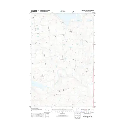
2013 Map of Northern Light Lake
USGS Topo · Published 2013About this map
Superior National Forest encompasses this aquatic-dominated landscape in Cook County, where a complex network of glacial lakes and drainages defines the topography. The Brule River and Greenwood River are central to the region's hydrography, connecting larger bodies of water such as Northern Light Lake and Greenwood Lake. The map details a remote wilderness infrastructure of Forest Service roads, including Greenwood Lake Rd and Powers Lake Rd, which provide access to more isolated features like Section Ten Lake and Puddle Lake. The intricate shoreline of Sunfish Lake and the meandering path of Assinika Cr illustrate the post-glacial drainage patterns characteristic of the Boundary Waters vicinity. This 2013 data provides a modern record of the interior forest road system and the preservation of these water resources within the national forest system.
Find a feature on this map
24 named features on this map. Tap any name to fly to it.
Don’t see what you’re looking for? This feature index may not catch every label — zoom into the map to look around manually.
Map Details
Editions of this 2013 Northern Light Lake Map
This is the sole edition of this map. No revisions or reprints were ever made.
Other maps of this area

1954 · Two Harbors
USGS Topo · 1:250,000

1957 · Two Harbors
USGS Topo · 1:250,000

1957 · Quetico
USGS Topo · 1:250,000

1958 · Two Harbors
USGS Topo · 1:250,000

1959 · Northern Light Lake
USGS Topo · 1:24,000

1959 · Pine Mountain
USGS Topo · 1:24,000

1959 · Pine Lake East
USGS Topo · 1:24,000

1959 · Tom Lake
USGS Topo · 1:24,000

1959 · Pine Lake West
USGS Topo · 1:24,000

1959 · Crocodile Lake
USGS Topo · 1:24,000