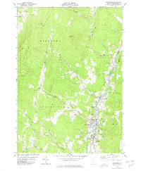
1980 Map of Northfield
USGS Topo · Published 1980About this map
The campus of Norwich University anchors the southern portion of this Washington County landscape, reflecting the military academy's long-standing presence in the area. Following the valley floor, the Central Vermont railroad runs parallel to the Dog River, a transportation corridor that shaped the growth of settlements like Northfield Falls and Northfield. The topography rises sharply from the riverbanks toward the Mountains to the west, where Moretown Gap and Waitsfield Gap provided essential passage through the high terrain.
Find a feature on this map
44 named features on this map. Tap any name to fly to it.
Don’t see what you’re looking for? This feature index may not catch every label — zoom into the map to look around manually.
Map Details
Editions of this 1980 Northfield Map
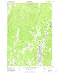
2 editions found
Other maps of this area

1919 · Lincoln Mountain
USGS Topo · 1:62,500

1919 · Montpelier
USGS Topo · 1:62,500

1920 · Lincoln Mountain
USGS Topo · 1:48,000

1921 · Richmond
USGS Topo · 1:48,000

1921 · Lincoln Mountain
USGS Topo · 1:62,500

1921 · Montpelier
USGS Topo · 1:62,500

1922 · Barre
USGS Topo · 1:48,000

1924 · Barre
USGS Topo · 1:62,500

1924 · Camels Hump
USGS Topo · 1:62,500

1944 · Montpelier
USGS Topo · 1:62,500