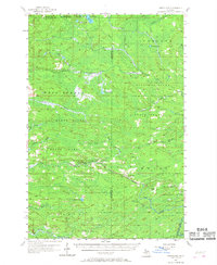
1957 Map of Northland
USGS Topo · Published 1968About this map
Northland and the rail siding at Reade anchor this survey of the dense Michigan timberlands along the border of Marquette and Dickinson counties. This mid-century landscape is defined by its vast river systems, including the complex drainage of the West Branch Escanaba and Ford River, which flow through expansive tracts of the Michigamme and Escanaba River State Forests. The C and NW RY line cuts a diagonal path through the terrain, connecting small clearings like the Education Camp and providing the primary infrastructure for the region's logging and transport economy.
Find a feature on this map
47 named features on this map. Tap any name to fly to it.
Don’t see what you’re looking for? This feature index may not catch every label — zoom into the map to look around manually.
Map Details
Editions of this 1957 Northland Map
2 editions found

Other maps of this area

1932 · Helena NW
USGS Topo · 1:31,680

1932 · Harvey SW
USGS Topo · 1:31,680

1932 · Helena SW
USGS Topo · 1:31,680

1951 · Helena SW
USGS Topo · 1:31,680

1951 · Helena NW
USGS Topo · 1:31,680

1952 · Ishpeming
USGS Topo · 1:62,500

1952 · Gwinn
USGS Topo · 1:62,500

1952 · Gwinn
USGS Topo · 1:24,000

1954 · Escanaba
USGS Topo · 1:250,000

1955 · Ralph NE
USGS Topo · 1:24,000