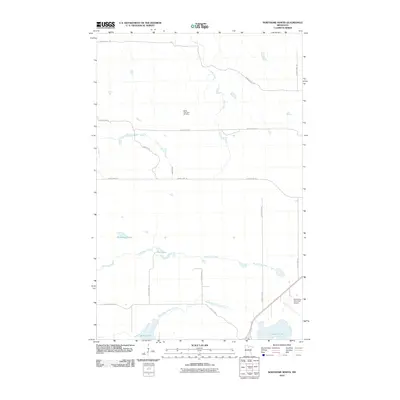
2010 Map of Northome North
USGS Topo · Published 2010About this map
Battle Lake Hills Ski Area sits at the heart of this northern landscape, marking a localized recreational hub within the glacial terrain of Koochiching County. The area is defined by its abundant water systems, where the South Branch Battle River meanders toward the larger Battle Lake and Bartlett Lake at the southern edge of the quadrangle. Transportation is a mix of utilitarian county highways and historic trails, including the Blue Ox Trl and Warren Trl, which navigate the wetlands and forests near Armstrong Creek and Pine Lake. On the southeastern periphery, the Northome Municipal Airport provides an essential connection for this part of the Northwoods. The map reveals a transition between managed recreational space and the natural flow of creeks like Elm Creek and Hoover Creek, illustrating how aviation, leisure, and regional water management intersected by the early 21st century.
Find a feature on this map
22 named features on this map. Tap any name to fly to it.
Don’t see what you’re looking for? This feature index may not catch every label — zoom into the map to look around manually.
Map Details
Editions of this 2010 Northome North Map
This is the sole edition of this map. No revisions or reprints were ever made.
Other maps of this area

1919 · Lundgren
USGS Topo · 1:62,500

1919 · Gemmell
USGS Topo · 1:62,500

1919 · Norden
USGS Topo · 1:62,500

1919 · Bridgie
USGS Topo · 1:62,500

1924 · Bridgie
USGS Topo · 1:62,500

1954 · Bemidji
USGS Topo · 1:250,000

1954 · Roseau
USGS Topo · 1:250,000

1957 · Roseau
USGS Topo · 1:250,000

1957 · Bemidji
USGS Topo · 1:250,000

1958 · Bemidji
USGS Topo · 1:250,000