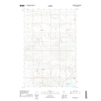
2019 Map of Northome North
USGS Topo · Published 2019About this map
Northome serves as the primary settlement in this part of Koochiching County, situated near the shores of Bartlett Lake. The landscape is defined by an intricate network of waterways and wetlands, including the S Br Battle River which feeds into Battle Lake. Further north, the terrain transitions into a more remote expanse of marshland and small creeks like Armstrong Cr and Elm Cr. The map highlights a localized transport infrastructure consisting of county roads and named tracks such as Flowing Well Trl and Warren Trl, which navigate the low-lying areas. The inclusion of the Northome Municipal Airport underscores the region's reliance on aerial connectivity given the saturated geography. For researchers, the map provides a clear picture of how modern drainage and road placement, such as Co Rd 15, conform to the natural hydrography of lakes like Silversack Lake and Pine Lake.
Find a feature on this map
24 named features on this map. Tap any name to fly to it.
Don’t see what you’re looking for? This feature index may not catch every label — zoom into the map to look around manually.
Map Details
Editions of this 2019 Northome North Map
This is the sole edition of this map. No revisions or reprints were ever made.
Other maps of this area

1919 · Lundgren
USGS Topo · 1:62,500

1919 · Gemmell
USGS Topo · 1:62,500

1919 · Norden
USGS Topo · 1:62,500

1919 · Bridgie
USGS Topo · 1:62,500

1924 · Bridgie
USGS Topo · 1:62,500

1954 · Bemidji
USGS Topo · 1:250,000

1954 · Roseau
USGS Topo · 1:250,000

1957 · Roseau
USGS Topo · 1:250,000

1957 · Bemidji
USGS Topo · 1:250,000

1958 · Bemidji
USGS Topo · 1:250,000