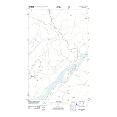
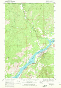
2011 Map of Northport
USGS Topo · Published 2011About this map
The town of Northport serves as the hub of this northern Washington landscape, situated along the banks where the Columbia River Bridge spans toward the Franklin D Roosevelt Lake reservoir. The map reveals a region defined by its industrial history and international proximity, with the Frontier Port of Entry marking the border crossing at the settlement of Frontier. Mining activity is extensively documented through several named sites including the Saint Crispen Mine, Double Standard Mine, Great Republic Mine, and Coyote Mine. These operations, along with Sherve Quarry, indicate a landscape heavily influenced by resource extraction.
Find a feature on this map
71 named features on this map. Tap any name to fly to it.
Don’t see what you’re looking for? This feature index may not catch every label — zoom into the map to look around manually.
Map Details
Editions of this 2011 Northport Map
This is the sole edition of this map. No revisions or reprints were ever made.
Other maps of this area

1929 · Colville
USGS Topo · 1:125,000

1933 · Colville
USGS Topo · 1:125,000

1952 · Spirit
USGS Topo · 1:24,000

1952 · Boundary
USGS Topo · 1:24,000

1958 · Sandpoint
USGS Topo · 1:250,000

1963 · Sandpoint
USGS Topo · 1:250,000
1969 · Belshazzar Mtn
USGS Topo · 1:24,000
1969 · Onion Creek
USGS Topo · 1:24,000
1969 · China Bend
USGS Topo · 1:24,000
1969 · Northport
USGS Topo · 1:24,000