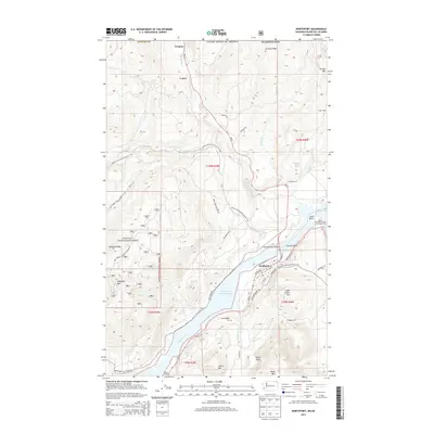
2014 Map of Northport
USGS Topo · Published 2014About this map
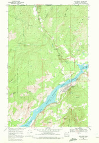
Northport serves as the central hub of this northern Stevens County survey, situated at a strategic bend of the Columbia River. The town's grid is clearly delineated, featuring Columbia Ave, Center Ave, and the Columbia River Bridge, which connects the settlement to the eastern bank. The surrounding landscape is defined by the high elevations of the Colville National Forest, where peaks like Flagstaff Mtn and Silver Crown Mtn tower over the river valley.
Find a feature on this map
77 named features on this map. Tap any name to fly to it.
Don’t see what you’re looking for? This feature index may not catch every label — zoom into the map to look around manually.
Map Details
Editions of this 2014 Northport Map
This is the sole edition of this map. No revisions or reprints were ever made.
Other maps of this area

1929 · Colville
USGS Topo · 1:125,000

1933 · Colville
USGS Topo · 1:125,000

1952 · Spirit
USGS Topo · 1:24,000

1952 · Boundary
USGS Topo · 1:24,000

1958 · Sandpoint
USGS Topo · 1:250,000

1963 · Sandpoint
USGS Topo · 1:250,000
1969 · Belshazzar Mtn
USGS Topo · 1:24,000
1969 · Onion Creek
USGS Topo · 1:24,000
1969 · China Bend
USGS Topo · 1:24,000
1969 · Northport
USGS Topo · 1:24,000