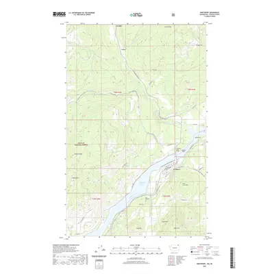
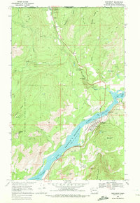
2020 Map of Northport
USGS Topo · Published 2020About this map
The Columbia River dominates the southern reaches of this landscape, its waters widening into Franklin D Roosevelt Lake as it passes the town of Northport. This riverfront settlement serves as a local hub, connected by the Columbia River Bridge and a grid of streets including Columbia Ave and Summit Ave. To the north, the terrain rises into the Colville National Forest, where the Pacific NW National Scenic Trail winds through high country marked by Grouse Ridge and Flagstaff Mtn. Smaller settlements such as Frontier and Velvet appear near the northern boundary, illustrating the dispersed residential patterns typical of this mountainous region. Local history is anchored by the Old Northport Cem and industrial landmarks like Smelter Rock, which sits on the riverbank across from Sand Point. Numerous watercourses, including Big Sheep Cr and Little Sheep Cr, drain the ridges, shaping the path of mountain roads like Little Sheep Creek Rd.
Find a feature on this map
58 named features on this map. Tap any name to fly to it.
Don’t see what you’re looking for? This feature index may not catch every label — zoom into the map to look around manually.
Map Details
Editions of this 2020 Northport Map
This is the sole edition of this map. No revisions or reprints were ever made.
Other maps of this area

1929 · Colville
USGS Topo · 1:125,000

1933 · Colville
USGS Topo · 1:125,000

1952 · Spirit
USGS Topo · 1:24,000

1952 · Boundary
USGS Topo · 1:24,000

1958 · Sandpoint
USGS Topo · 1:250,000

1963 · Sandpoint
USGS Topo · 1:250,000
1969 · Belshazzar Mtn
USGS Topo · 1:24,000
1969 · Onion Creek
USGS Topo · 1:24,000
1969 · China Bend
USGS Topo · 1:24,000
1969 · Northport
USGS Topo · 1:24,000