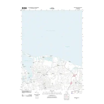
2011 Map of Northport
USGS Topo · Published 2011About this map
Northport and its neighboring North Shore communities are meticulously documented in this 2011 survey, revealing a landscape defined by its deep maritime heritage and established residential patterns. The map highlights the complex coastline stretching from Asharoken Beach to Makamah Beach, where Northport Harbor and Centerport Harbor provide sheltered waters. An exceptional concentration of burial grounds, including the Northport Rural Cemetery, Scidmore Cemetery, and the Saint Philip Neri Cemetery, offers significant detail for genealogists tracing local family histories. Inland, the map captures the transition from village centers like Vernon Valley and Middleville to the agricultural legacy represented by Richters Orchards. The dense road network, from Asharoken Ave to the Sunken Meadow State Pkwy, illustrates the suburban development of Suffolk County while maintaining clear geographic markers like Blanchard Lake and Fresh Pond that have shaped the region's character for generations.
Find a feature on this map
49 named features on this map. Tap any name to fly to it.
Don’t see what you’re looking for? This feature index may not catch every label — zoom into the map to look around manually.
Map Details
Editions of this 2011 Northport Map
This is the sole edition of this map. No revisions or reprints were ever made.
Other maps of this area

1891 · Bridgeport
USGS Topo · 1:62,500

1892 · Norwalk
USGS Topo · 1:62,500

1893 · Bridgeport
USGS Topo · 1:62,500

1893 · Norwalk
USGS Topo · 1:62,500

1901 · Northport
USGS Topo · 1:62,500

1902 · Setauket
USGS Topo · 1:62,500

1903 · Northport
USGS Topo · 1:62,500

1904 · Setauket
USGS Topo · 1:62,500

1904 · Islip
USGS Topo · 1:125,000

1919 · Setauket
USGS Topo · 1:62,500