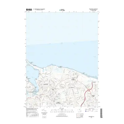
2016 Map of Northport
USGS Topo · Published 2016About this map
Long Island Sound shapes the northern coast of this territory, where the narrow spit of Asharoken stretches toward Duck Island Harbor and the protected waters of Northport Bay. The dense network of residential streets in Northport and East Northport is balanced by significant green spaces and historical burial grounds. Genealogists can identify several distinct cemeteries, including the Northport Rural Cem and the Scidmore Cem near Steer's Beach. To the east, the landscape transitions toward Fort Salonga and the expansive Sunken Meadow Meadow. The map also details the smaller communities of Vernon Valley and Middleville, alongside local landmarks like Bird Island and the coastal bluffs at Bluff Point. This layout illustrates the mid-2010s suburban character of Huntington, preserved alongside its maritime heritage and numerous family-named landmarks.
Find a feature on this map
173 named features on this map. Tap any name to fly to it.
Don’t see what you’re looking for? This feature index may not catch every label — zoom into the map to look around manually.
Map Details
Editions of this 2016 Northport Map
This is the sole edition of this map. No revisions or reprints were ever made.
Other maps of this area

1891 · Bridgeport
USGS Topo · 1:62,500

1892 · Norwalk
USGS Topo · 1:62,500

1893 · Bridgeport
USGS Topo · 1:62,500

1893 · Norwalk
USGS Topo · 1:62,500

1901 · Northport
USGS Topo · 1:62,500

1902 · Setauket
USGS Topo · 1:62,500

1903 · Northport
USGS Topo · 1:62,500

1904 · Setauket
USGS Topo · 1:62,500

1904 · Islip
USGS Topo · 1:125,000

1919 · Setauket
USGS Topo · 1:62,500