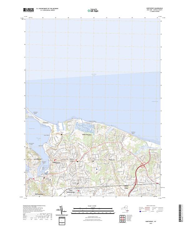
2023 Map of Northport
USGS Topo · Published 2023About this map
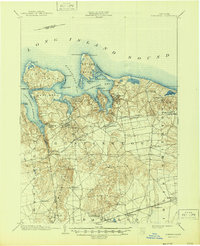
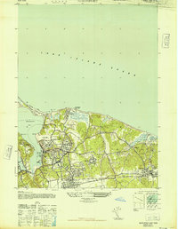
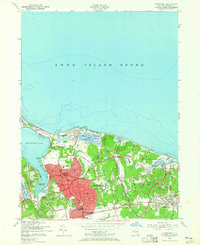
Northport Bay and the northern shore of Long Island define this coastal survey, where the narrow spit of Asharoken stretches west toward Eatons Neck Road. The maritime character of the region is evident in the protected waters of Centerport Harbor and the Northport Basin, supporting a dense network of residential streets that expanded inland from the waterfront. Genealogists will find a significant concentration of burial grounds, including the historic Northport Rural Cemetery and the Old Northport Cemetery, which speak to the long-standing community roots in the area. Further east, the landscape transitions to the open spaces of Sunken Meadow and the wetlands around Sunken Meadow Creek, while the settlement of Fort Salonga occupies the high ground overlooking the Long Island Sound. The map preserves the specific locations of landmarks like the enigmatic Opcahtontyche, alongside established neighborhoods in Kings Park and East Northport.
Find a feature on this map
211 named features on this map. Tap any name to fly to it.
Don’t see what you’re looking for? This feature index may not catch every label — zoom into the map to look around manually.
Map Details
Editions of this 2023 Northport Map
This is the sole edition of this map. No revisions or reprints were ever made.
Historical Maps of Middleville Through Time
6 maps found